Specification
Layer yandex-tile is designed to display on interactive map tile layers Google maps,
however, how the layer is somewhat different from the work classic tile layers.
The fact that Yandex does not give direct access to talovym services Google maps, their use is permitted only through the official API Yandex maps.
Layer yandex-tile loads API Yandex maps, adds inside interactive maps full instance of Yandex-maps with the specified settings, and then throughout the interactive map just proxy it (displacement map, changing zoom, etc.) on a sub-Yandex-map.
Ember-layer component and its properties
Ember-component layer is located in a special addon ember-flexberry-gis-yandex along the way ember-flexberry-gis-yandex/addon/components/layers/tile-yandex-layer and supports the following set of properties that match the same name with them to the settings in the object settings in the model layer:
| The name of the property | Type of property | Description |
|---|---|---|
type |
String |
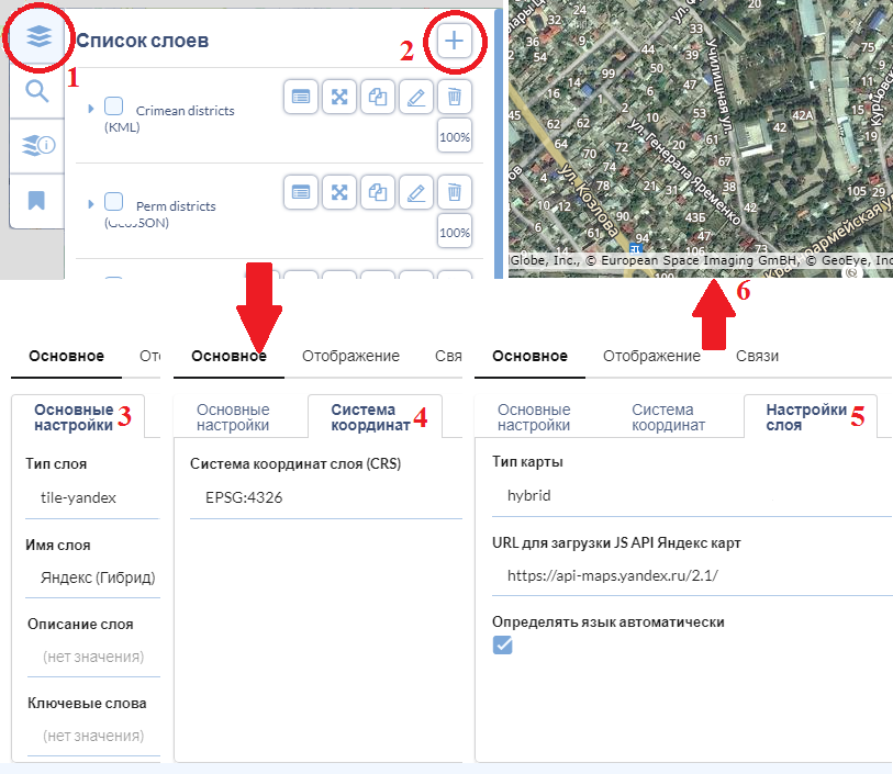
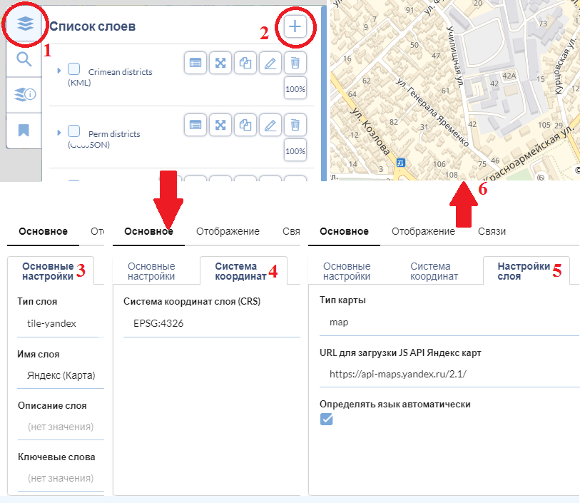
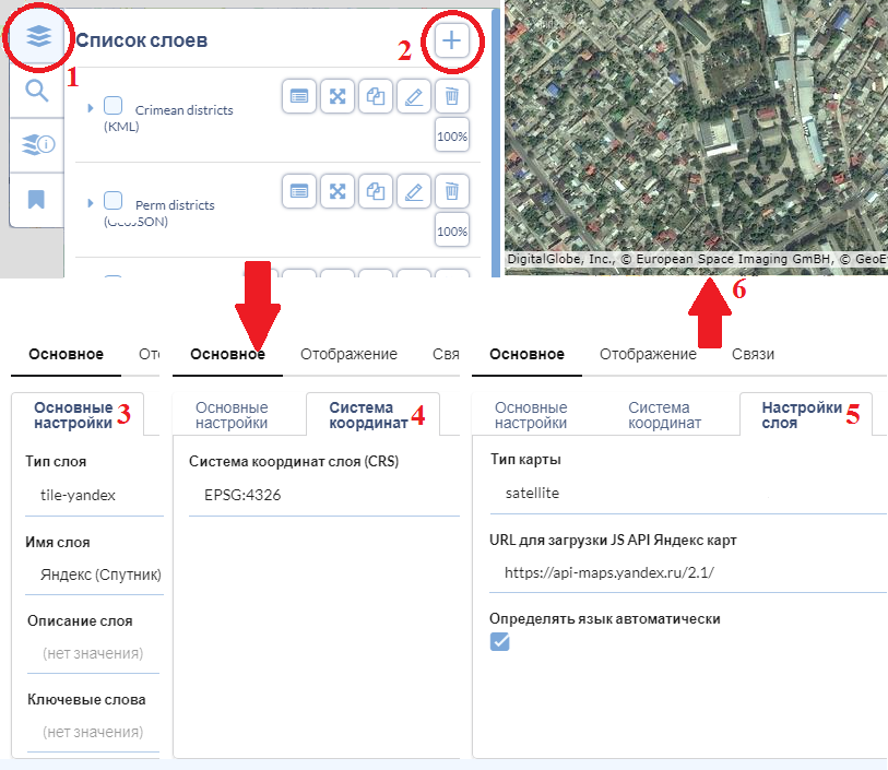
the Type of desired tile layer Yandex-maps, which can take values of ‘map’ (the usual hand-drawn map), the ‘satellite (satellite images)’, ‘hybrid’ (a hybrid map combining hand-drawn roads and other facilities with the backing of satellite imagery), and has a default value of ‘map’ |
jsApiUrl |
String |
URL to download the API, Yandex maps, default is ‘https://api-maps.yandex.ru/2.1/’ |
detectLanguageAutomatically |
Boolean |
Flag: shows whether auto-detect the language of the app to use it as a ‘lang’ parameter in the URL-e, when you download the API Yandex maps. By default have the value true. If you enable it the value false, then you will need to explicitly specify one of the supported languages (‘ru_RU’, ‘ru_UA’, ‘en_US’, ‘en_RU’, ‘uk_UA’, ‘tr_TR’) in the attribute jsApiUrl in the form of ULR-parameter ‘lang’: https://api-maps.yandex.ru/2.1/?lang=en_us |
Examples of usage
Example of adding to the map tile layer is drawn Yandex-maps:
Example of adding a map tile layer Yandex-maps with satellite imagery:
Example of adding a map tile layer Hybrid Yandex-maps, combining hand-drawn roads and other facilities with the backing of satellite images: